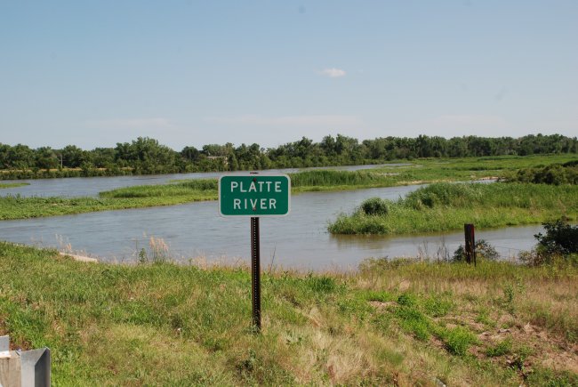
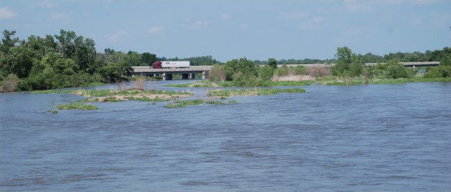
July 19, 2008: The Platte River at the Nebraska Highway 34 bridge, just east of Grand Island, NE.
The Platte River is Flowing Again After Seven Years of Drought
Photo Images © Ken Dewey, SNR, UNL.
July 19, 2008: The Platte River at the
Nebraska Highway 34 bridge, just east of Grand Island, NE.
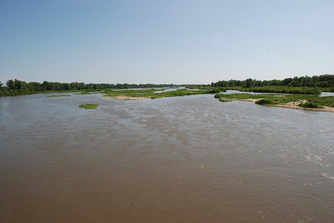
July 19, 2008: The Platte River at the
Nebraska Highway 34 bridge just east of Grand Island, NE, looking southwest.
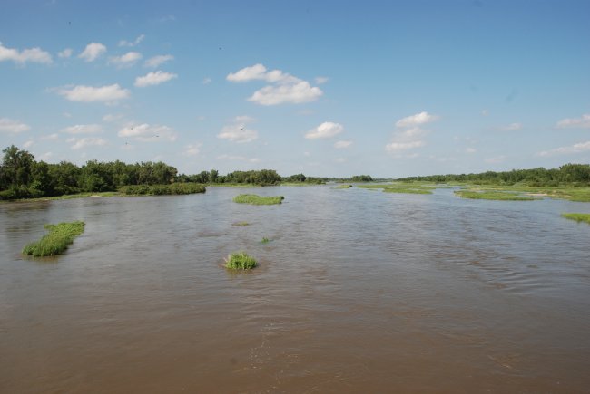
July 19, 2008: The Platte River at the Nebraska Highway 34 bridge just east of
Grand Island, NE, looking northeast.
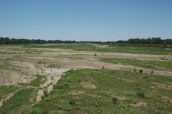
TWO years ago ----- June 6,
2006: LINK:
June 6, 2006 Report
Looking
northeast at the main channel of the Platte River from the Nebraska Highway
34 bridge
at the
Hamilton/Hall County border and about 5 miles east of Grand Island.
July 19, 2008: The Platte River viewed from the Locust Street bridge south of
Grand Island, NE. I-80 is in the distance.
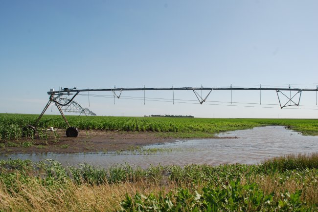
July 19, 2008: Near Grand Island, NE. A very wet summer has meant no need for irrigation in this corn field.
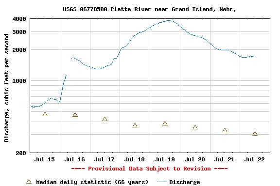
Platte River Discharge from July 15-22, 2008.
Note the discharge on July 19, the time of the above photos was 3800 cubic feet
per second.
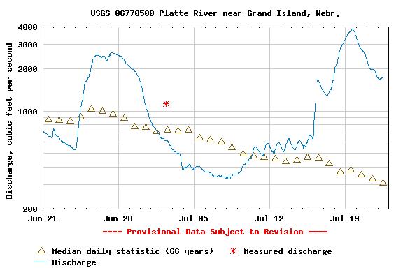
Platte River Discharge from June 21-July 22, 2008.
Note the discharge on July 19, the time of the above photos was 3800 cubic feet
per second.
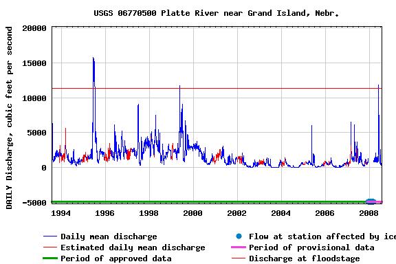
Platte River Discharge from July 1994 - July 2008.
Note that the Platte River reached "flood stage" on May 27-28, 2008 for the
first time since 1999.