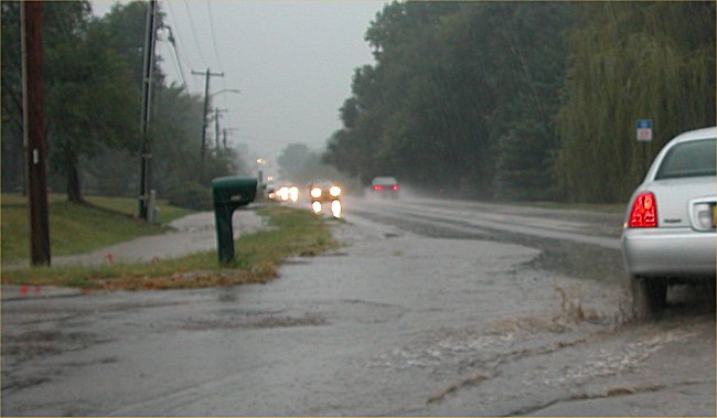
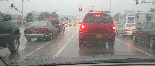
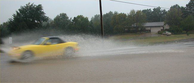
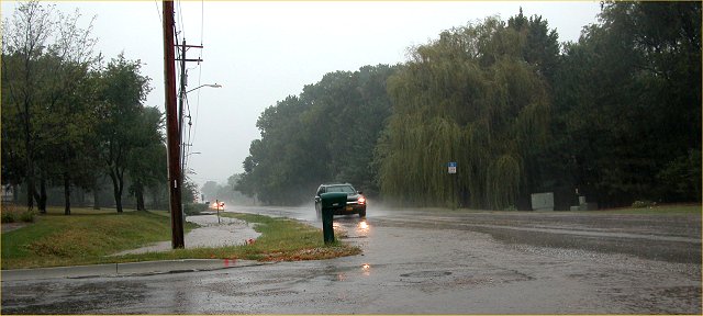
September 21, 2004 Heavy Rainfall in the Lincoln, Nebraska Vicinity

Southeast Lincoln

Southeast Lincoln


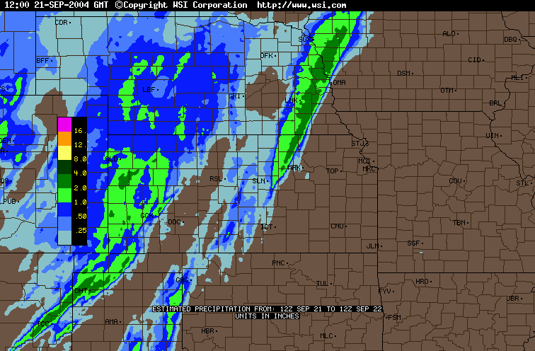
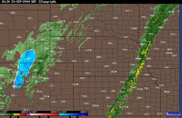
Radar estimated precipitation, 12 Z (7 AM CDST) September 21 to 12 Z (7 AM CDST) September 22, 2004
Note the narrow band of heavy precipitation stretching from near Salina, KS (SLN) to
northwest Iowa near Sioux City (SUX).  Lincoln is LNK and the official airport measurement.  Southeast Lincoln
had rainfall amounts exceeding 2 inches with the official airport measurement of 1.39 inches, which was
a new record daily precipitation amount for the date.

EASTERN NEBRASKA AND SOUTHWEST IOWA
:TEMPERATURE AND PRECIPITATION STATIONS
:...................................................
:       STATION              MAX / MIN  / 24-HR   / 
:        NAME                TEMP/ TEMP / PRECIP  / 
:....................................................
 

Precipitation amounts are in inches:
:
:EASTERN NEBRASKA

BVN  :  ALBION AIRPORT    :   72 /  54  /  0.02 
BIE  :  BEATRICE AIRPORT  :   72 /  63  /  1.43 
OLU  :  COLUMBUS AIRPORT  :   73 /  59  /  0.02 
FNB  :  FALLS CITY ARPT   :   88 /  56  /  0.00 
FET  :  FREMONT AIRPORT   :   72 /  64  /  0.91 
LNK  :  LINCOLN AIRPORT   :   74 /  63  /  1.41 
AFK  :  NEBRASKA CITY ARPT:   84 /  63  /  0.00 
OFK  :  NORFOLK AIRPORT   :   73 /  57  /  0.04 
OFF  :  OFFUTT AFB        :   72 /   M  /  0.04 
OMA  :  OMAHA/EPPLEY      :   71 /  64  /  0.48 
MLE  :  OMAHA/MILLARD     :   70 /  63  /  2.54 
TQE  :  TEKAMAH AIRPORT   :   73 /  64  /  2.39 
OAX  :  VALLEY NWS        :   72 /  64 /   2.72 
 

Note the abrupt drop-off in precipitation with Omaha Millard receiving 2.54 inches of
precipitation, yet Omaha Eppley receiving only 0.48 inches of precipitation.  Lincoln's
total of 1.41 inches includes an additional 0.02 inches that fell after midnight.


Note how the thunderstorms keep passing over the same narrow region from Beatrice (BIE) to
near Sioux City (SUX).  This phenomenon of thunderstorms repeatedly passing over the same location is
often referred to as "training" i.e. similar to a train of cars passing down a track.  The blue area on
the radar image in Wyoming and Colorado is SNOW!


Southeast Lincoln.


Southeast Lincoln

Mid-town Lincoln with rush hour traffic slowed by the heavy rainfall.


Return to:  The Photo Gallery Index Page