Lake McConaughy is 62.7 feet below maximum elevation!
All Images © Ken Dewey

October 8, 2007: Elevation
today 3207.3 feet, Elevation one year ago today 3200.2 feet.
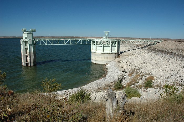

This
Year: October 8, 2007:
Lake
McConaughy Surface elevation 3207.3 feet (62.7 feet below maximum
elevation)
Volume
= 475,000 acre feet
%
of Maximum volume = 27.3%
Last
Year: October 7, 2007:
Lake
McConaughy Surface elevation 3200.2 feet
Volume
= 374,500 acre feet
%
of Maximum volume = 21.5%
Maximum
elevation is 3270 feet.
maximum
volume (storage) is 1,900,600 acre feet

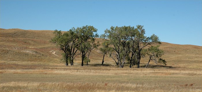
October 8, 2007: Nebraska
Sandhills along Nebraska Hwy. 61 between Hyannis and Lake McConaughy.
This is similar to much of the
region upstream from Lake McConaughy which is still in drought conditions.
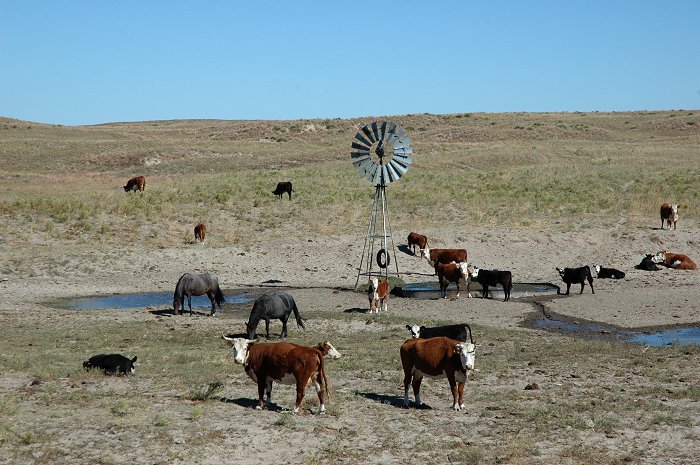
October 8, 2007: Nebraska
Sandhills along Nebraska Hwy. 61 between Hyannis and Lake McConaughy.
This is similar to much of the
region upstream from Lake McConaughy which is still in drought conditions.

October 8, 2007: Nebraska
Sandhills near Alliance, Nebraska.
This is similar to much of the
region upstream from Lake McConaughy which is still in drought conditions.

October 8, 2007: Nebraska
Sandhills near Alliance, Nebraska.
Very little water remains in
this lake.
The
Platte River, Central Nebraska - Drought Update
October
8, 2007
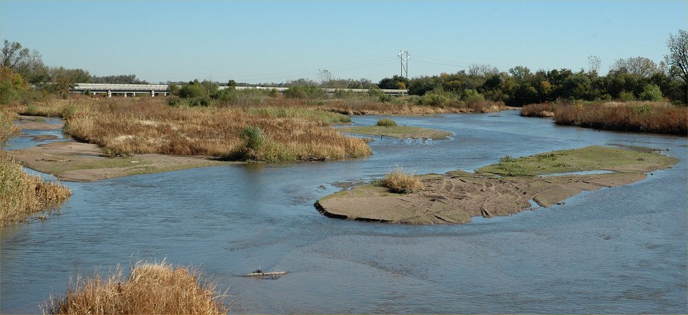
October 8, 2007: The Platte
River, looking northeast at the I-80 bridge south of Grand Island, Nebraska.
The October 8, 2007 discharge
was 655 cfs or about 50% of the mean for this date, and it was slightly
elevated due to overnight rainfall in the area.
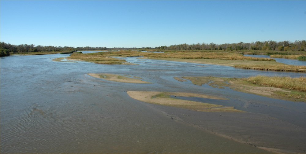
October 8, 2007: The Platte
River, looking south from the Nebraska Hwy 34 bridge east of Grand
Island.
The October 8, 2007 discharge
was 655 cfs or about 50% of the mean for this date, and it was slightly
elevated due to overnight rainfall in the area.
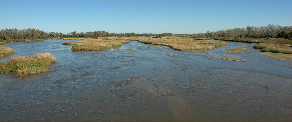
October 8, 2007: The Platte
River, looking north from the Nebraska Hwy 34 bridge east of Grand
Island.
The October 8, 2007 discharge
was 655 cfs or about 50% of the mean for this date, and it was slightly
elevated due to overnight rainfall in the area.
October
8, 2007:
Platte
River October 8, 2007 discharge at Grand Island: 655 cubic feet per
second cfs).
One
week ago discharge at Grand Island = 317 cfs.
One
year ago discharge at Grand Island = 331 cfs.
Minimum
October 8 discharge: 0 cubic feet per second in 1942.
Mean
October 8 discharge = 1300 cfs.
Maximum
October 8 discharge: 8650 cfs 1974 .

Platte
River discharge October 3, 2007 through October 10, 2007
The
Platte River photos above were taken on October 8 at the peak
of
the rainfall discharge from the storms overnight October 7-8, 2007.
Platte
River discharge October 8, 2006 through October 8, 2007

Return to: The Photo Gallery Index Page