 |
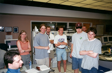
We had 4 cars and a total of
11 people on this storm chase.
We left Lincoln at 11 AM and stopped at the Hastings, NE NWS Office. We were given an update on the various forecast products and current observations. Here, Ken Drozd, (lower left corner
of the photo) lead forecaster at the NWS office
|
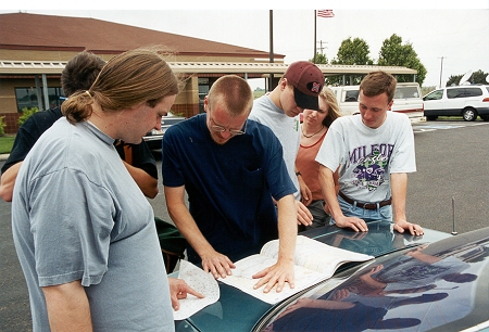 |
Gathering together outside the
Hastings, NE NWS office with several copies of the
latest NWS weather maps, the students then discussed where the target intercept area should be and how to get there. |
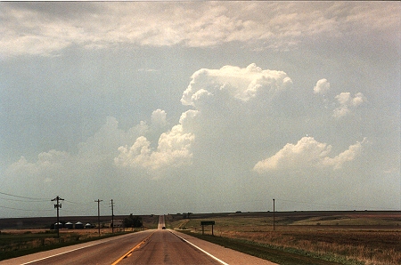 |
We positioned ourselves in Arapahoe,
Nebraska, just east of Mc Cook, NE and
south of Lexington, NE. The warm front was about 25 miles to the north and the dry line had just pushed through Mc Cook. Convective initiation had begun and the cell shown here became a small supercell within 20 minutes. |
|
|
|
|
|