Storm Chase,
Lincoln, NE to Northwestern Kansas.
All Images
© Ken Dewey, School of Natural Resources, UNL
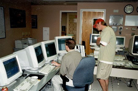
We start the chase by getting a weather briefing
from Brian Montgomery at the Hastings, NE, NWS office.
We headed south and then west to a rural area about 15 miles west
of Phillipsburg, KS. Much of the area had remained cloud covered
except for this region and it was likely that convection would break
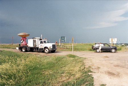
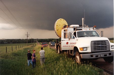
the cap in this area. Shortly after our arrival, Doppler on Wheels (DOW)
arrived and began to scan the one developing supercell.
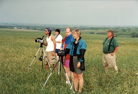
Other storm chasers began to arrive
and set up their video and camera equipment.
With only
one supercell developing, this was the "only game in town".
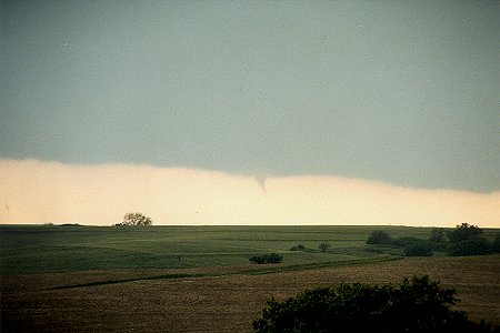
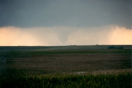
After about
an hour of development, it finally began to form
a small
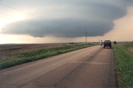
funnel. We then moved north and west about 5 miles.
The wall
cloud was massive and showing strong rotation,
unfortunately
the funnel was rain wrapped at this point.
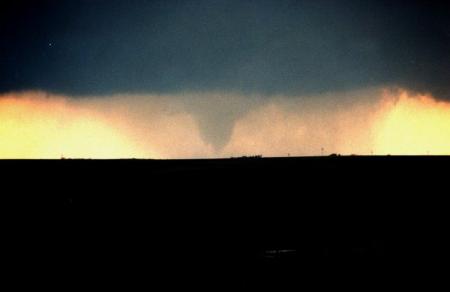
The rain shield began to thin and a 1/4 wide tornado on the ground
now became visible.
Using a
filter, it was possible to more easily see the rain wrapped tornado.
.
A county Sheriff arrived and we watched the tornado dissipate.
He indicated that the tornado had just missed Almena, KS,
however, it had moved across a farm house totally destroying it.
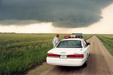
The supercell was only moving at 15 mph and
showed potential for putting down additional tornadoes.
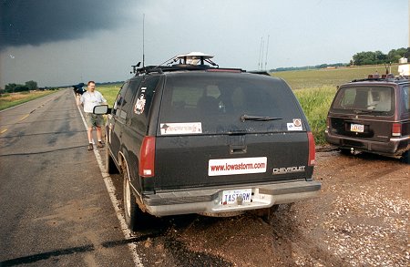
DOW 1 & 2 remained in the area scanning the mesocyclone.
Other chase teams had also congregated in the area. Here is team from
iowastorm.com and a chase vehicle from Omaha, NE.
The NWS
radar out of Hastings, NE radar continued to show strong
rotation
within the mesocyclone, so they issued a tornado warning
for the
projected path of the mesocyclone, which was
expected
to cross the Republican River and be near Alma, NE at sunset.
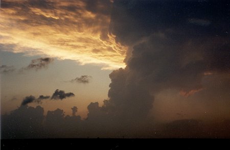
As the
sun set, the once powerful supercell fell apart over Alma, NE.
Return to: The Photo Gallery Index Page