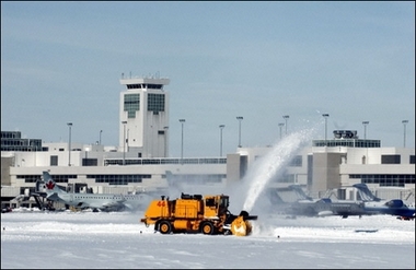
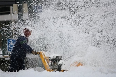
Snow movers work to clear the
runways at Denver International Airport, Colorado. The recent blizzard
left thousands of travelers stranded and also caused a shut down of the
city and highways exiting Denver.(AFP/Getty Images/Thomas Cooper)
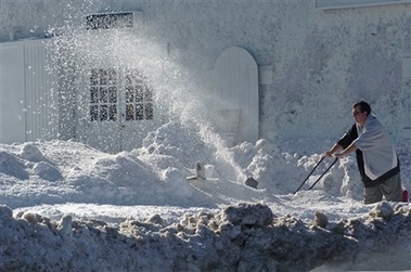
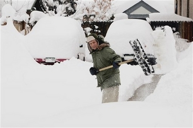
A man uses a snowblower to clear
a business parking lot in Denver, Friday, Dec. 22, 2006, after a paralyzing
two-day snowstorm. (AP Photo/Bill Ross)
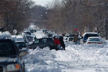
Motorists work on digging out
their cars on a snow-covered street in Denver, Friday, Dec. 22, 2006. A
major snowstorm blew across Colorado toward the Plains on Wednesday, canceling
hundreds of airline flights for holiday travelers and shutting down major
highways in parts of four states. (AP Photo/Bill Ross)
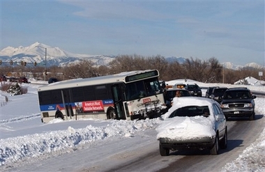
A Regional Transportation District
bus sits sidelined on Colorado Highway 297 in Lafayette, Colo., Friday,
Dec. 22, 2006, The bus has been on the side of the highway since Wednesday's
snowstorm sidelined the bus. (AP Photo/Peter M. Fredin)
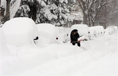
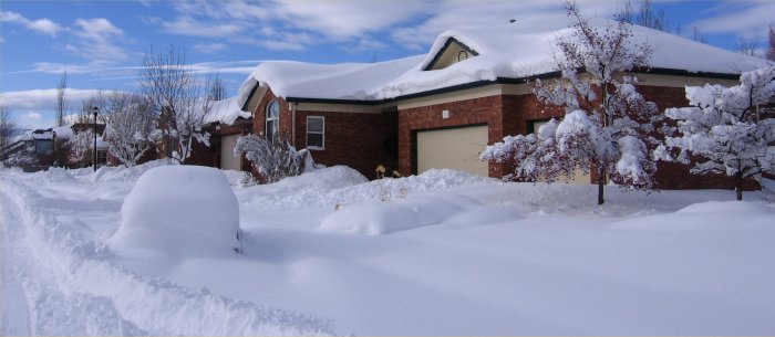
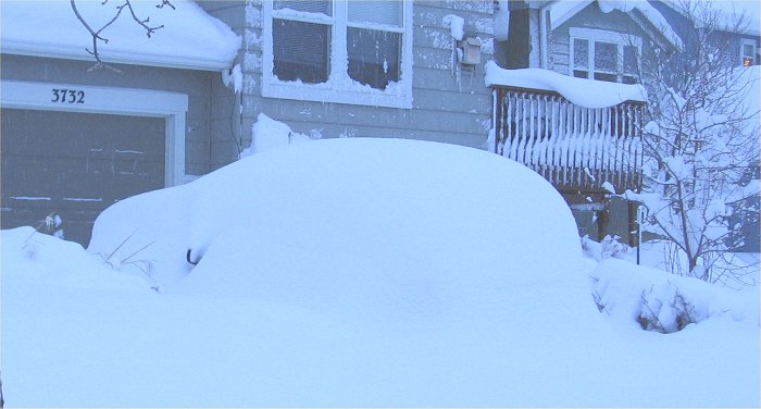
Vehicles sit buried after a blizzard
swept over Denver in a neighborhood on the city's westside on Friday, Dec.
22, 2006. Some mountain areas got more than 3 feet (90 centimeters) of
snow, and up to 25 inches (63.5 centimeters) fell in the Denver metropolitan
area. Bus and train service was shut down. (AP Photo/David Zalubowski)
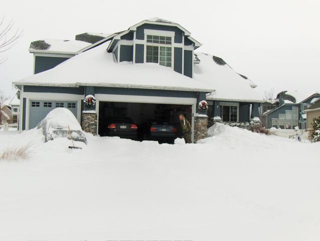
Sheldon Van Valkenburg clears
his driveway of snow in Denver, Thursday, Dec. 21, 2006. A powerful winter
storm brought heavy snow and strong winds to Colorado Wednesday and Thursday
closing Denver International Airport and shutting down most of the state
east of the Rocky Mountains. (AP Photo/Ed Andrieski).
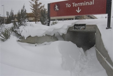
Airport collects blowing snow,
preventing passengers from walking to the terminal, Thursday, Dec. 21,
2006. A powerful blizzard has closed the airport until Friday afternoon.
(AP Photo/Will Powers)
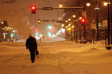
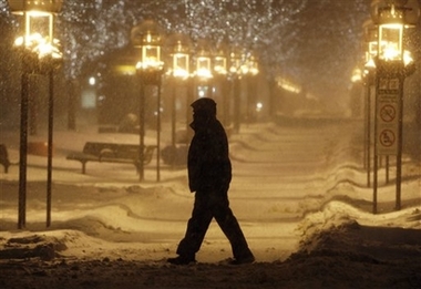
Jesus Velasquez gets a face full of snow as he tries clearing the
Union Station platform for the Light Rail in Denver, Colo. on Thursday
Dec. 21, 2006. (AP Photo/Andrew Otto)
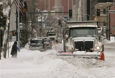
A snowplow clears 18th Street
in downtown Denver on Thursday, Dec. 21, 2006. A powerful winter storm
brought heavy snow and strong winds to Colorado Wednesday and Thursday
closing Denver International Airport and shutting down most of the state
east of the Rocky Mountains. (AP Photo/Ed Andrieski)
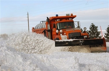
A Colorado Department of Transportation
snowplow clears Highway 287 south of Longmont, Colo., Thursday, Dec. 21,
2006. (AP Photo/Peter M. Fredin)
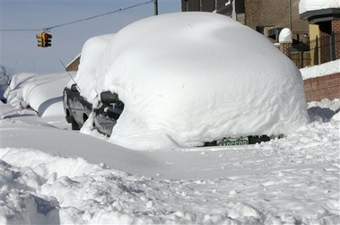
A snow-covered automobile waits
to be dug out in downtown Denver, Thursday, Dec. 21, 2006. Nearly 5,000
travelers who mistakenly thought they were beating the Christmas rush struggled
to find a hotel room or faced another night on the hard floor at Denver's
snowbound airport Thursday after a blizzard paralyzed the city. (AP Photo/Bill
Ross)
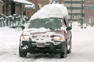
A snow-capped SUV makes its way
through the streets in downtown Denver, Thursday, Dec. 21, 2006. A major
snowstorm blew across Colorado toward the Plains on Wednesday, canceling
hundreds of airline flights for holiday travelers and shutting down major
highways in parts of four states. (AP Photo/Bill Ross)
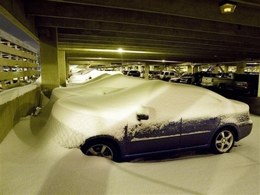
Cars are covered with snow drifts
at Denver International Airport, Thursday, Dec. 21, 2006. A powerful snowstorm
paralyzed Colorado's biggest cities with up to 2 feet of snow. (AP Photo/Will
Powers)
Mary Swartz digs her car out
of the snow in Denver on Thursday, Dec. 21, 2006. A powerful winter storm
brought heavy snow and strong winds to Colorado Wednesday and Thursday
closing Denver International Airport and shutting down most of the state
east of the Rocky Mountains. (AP Photo/Ed Andrieski)
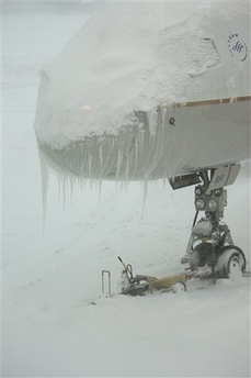
AP - Thu Dec 21, 1:45 PM ET A
Continental Airlines plane sits near the concourse at Denver International
Airport covered with ice and snow Thursday, Dec. 21, 2006. A powerful snowstorm
has closed the airport until Friday. The planes will have to be de-iced
and the runways cleared before the airport can open. (AP Photo/Will Powers)
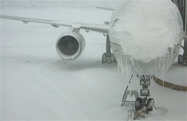
AP - Thu Dec 21, 1:44 PM ET A
Continental Airlines plane sits near the concourse at Denver International
Airport covered with ice and snow Thursday, Dec. 21, 2006.
(AP Photo/Will Powers)
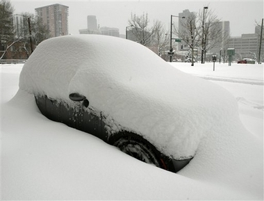
A vehicle is covered with snow
in a parking spot in downtown Denver on Thursday, Dec. 21, 2006. More than
two feet of snow fell on some parts of Colorado before a powerful snowstorm
moved out of the interior West on Thursday. (AP Photo/David Zalubowski)
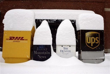
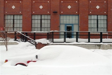
Snow tops the boxes on a street
corner in downtown Denver on Thursday, Dec. 21, 2006. (AP Photo/David
Zalubowski)
Snow tops the boxes on a street
corner in downtown Denver on Thursday, Dec. 21, 2006. (AP Photo/David Zalubowski)
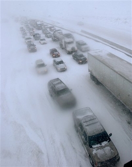
Traffic along southbound Interstate
25 toward Denver at the Colorado Highway 7 overpass comes to a standstill
during a winter storm, Wednesday, Dec. 20, 2006, near Erie, Colo. (AP Photo/Peter
M. Fredin)