November 12, 2004
Photos and Flow (discharge) Graphs
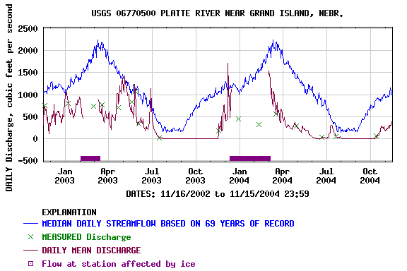
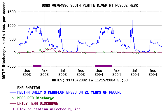
Note the thin purple line which shows the mean daily discharge (flow). The flow completely stopped
during the summer of 2003 and 2004 (as well as 2002 but not shown on the graph).
As noted on the graph and the photos below, the flow has started up again with the irrigation
season ended. The thick purple line just above the date line indicates no data due to ice conditions.
Flow (discharge) data and graphs from the USGS Water Resources Data for the Nation
also see:
A Major
Drought hits Lake McConaughy
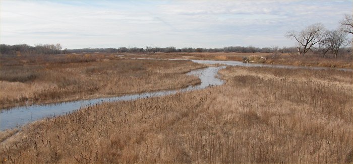
Image © Ken Dewey, SNR, UNL
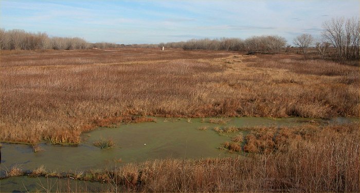
Looking Southwest from the Locust Street bridge over the Platte River near Grand Island.
A small flow has returned to the river. See map below for exact location.
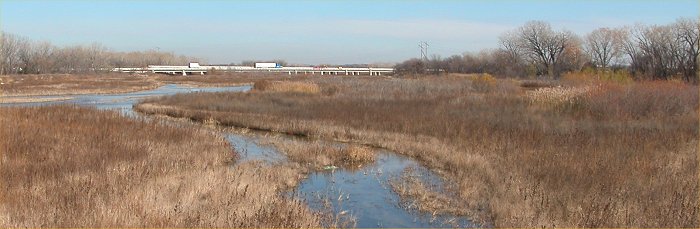
Image
© Ken Dewey, SNR, UNL
Looking
Northeast from the Locust Street bridge over the Platte River near Grand
Island.
Interstate
80 is in the distance. See map below for exact location.
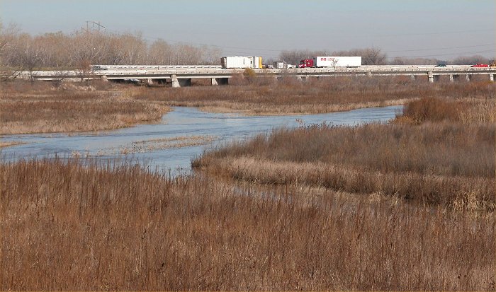
Image
© Ken Dewey, HPRCC
Looking
Northeast from the Locust Street bridge over the Platte River near Grand
Island.
Interstate
80 is in the distance. See map below for exact location.
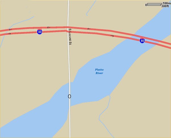
The large O on Locust Street
indicates the location where the above photos were taken.