Southwest Drought Impact Photos
LasVegas, NV, Lake Mead Area, and the Southwest
October 2002

(Link to Summary statistics, data)


Lake Mead
All Images © Ken Dewey, Applied Climate Sciences, School of Natural Resources, UNL
Lake Mead from about 10,000 feet above the surface. 
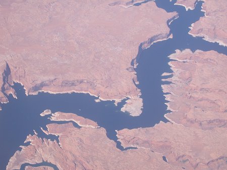
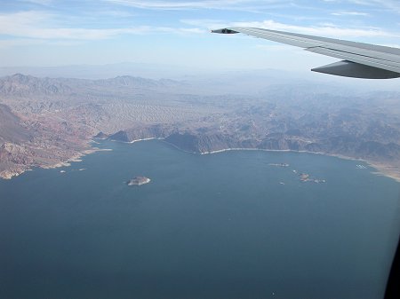
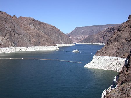
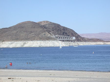
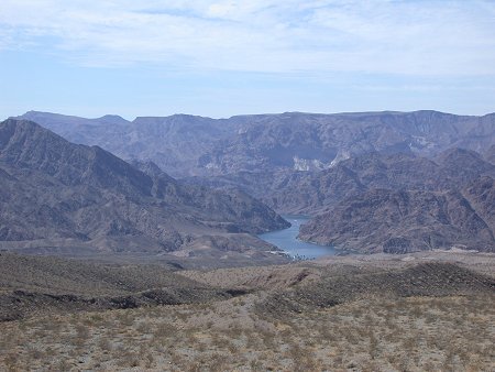
Note the white ring around the lake.
Lake Mead behind Hoover Dam.  The white ring is the 
rock area that is normally below water, but is now exposed. 
Click HERE or on the above photo to see a much larger version.
Looking south at Hoover Dam.  Note the spillway along 
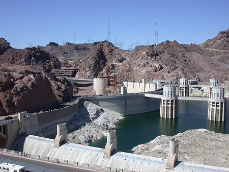
the bottom of the photo and the white ring on the dam
wall.  Although the lake level is at its lowest in years, 
electrical production is unaffected. Click HERE or on 
the above photo to see a much larger version.
The structure in the distance is the water intake for the city 
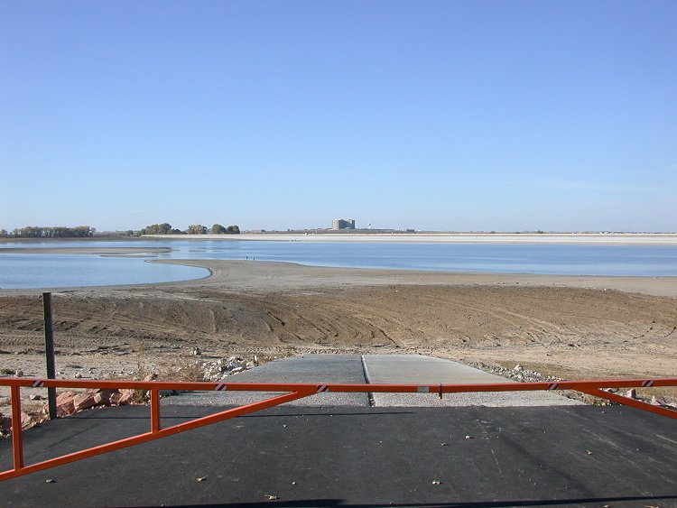
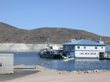
of  Las Vegas, NV.  This structure had to be moved due to 
the dropping level of Lake Mead and is one of several 
drought related expenses. Click HERE or on the above 
photo to see a much larger version.
The marina has moved several times and parking lots 
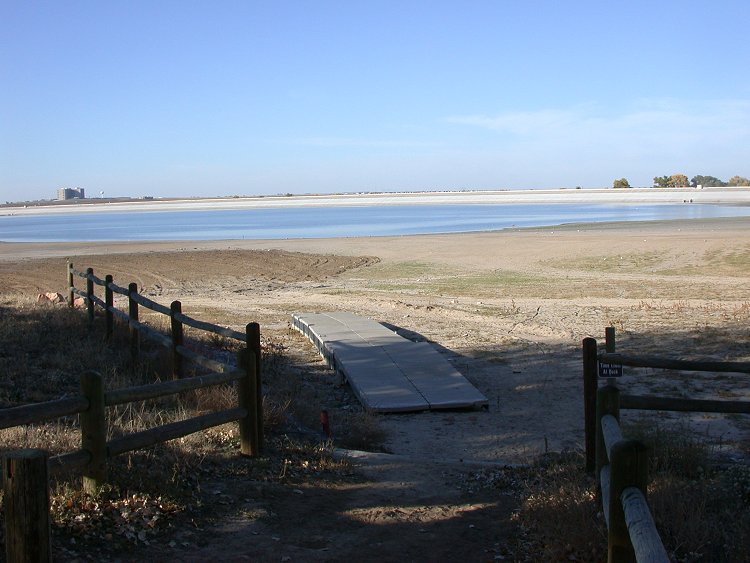
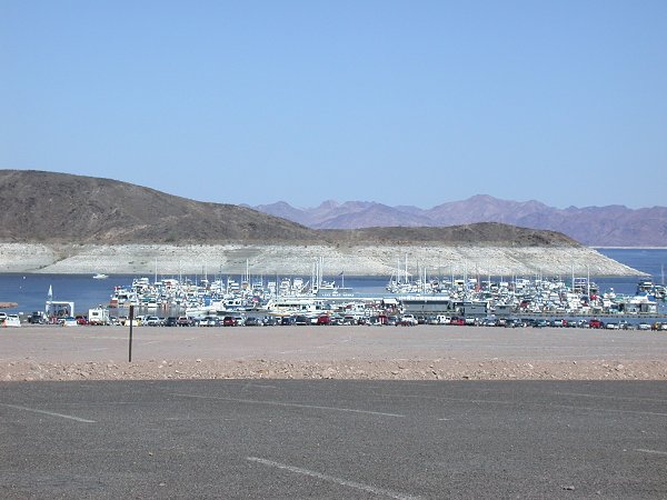
built and extended out onto the exposed lake bed due to the dropping elevation of the lake.
Economic losses to the facility included the cost of moving 
the marina, regrading parking lots, moving sanitation 
facilities and lost revenue from decreased numbers of visitors.
The edge of the water in Lake Mead used to reach all the 
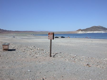
way up to within a few feet of the sing seen in the foreground. 
The shoreline has receded well into the distance.
This is looking down at the Colorado River about 20 miles downstream from Hoover Dam. Click HERE or on the 
above photo to see a much larger version.

Las Vegas, Nevada - October 2002
All Images © Ken Dewey, Applied Climate Sciences, School of Natural Resources, UNL


The Las Vegas "Strip", the casinos and hotels along Las Vegas Blvd., is barely visible through the smog hanging over the city.
Approximately 5,000 new residents arrive in Las Vegas WEEKLY which casts a dark cloud on future water availability in a city
that normally only receives 4 inches of rain per year.

Despite the serious drought and significant drop in water elevation at Lake Mead, ample water is found throughout Las Vegas.
There are several residential communities recently built around man made lakes in Las Vegas.
In a survey of golf course operators, it was found that 
they irrigate the courses daily.
The poor soil means little water retention, and shallow
turf root development, requiring frequent irrigation. 
Another example of ample water supply during a major drought is found along the Las Vegas Strip.  Here "dancing waters" spray 12 stories into the air in front of the Bellagio Hotel both night
and day.
And each hotel along the strip has swimming pools that are large users of water.  During the hot summer days with  low humidity, there is constant and large evaporation from these pools.
The relative humidity in the hills outside Las Vegas 
was measured at only 2 %.
This image was acquired from "Terraserver.com" and shows 
3 ribbon-like man-made lakes in western Las Vegas, NV.
This golf course in far SW Las Vegas with its green fairways 
stands in stark contrast to the surrounding brown desert.
Ironically, despite Las Vegas being a desert, flash flooding 
is recurring hazard due to the lack of vegetation holding 
back runoff.  This sign was photographed in North
Las Vegas near a dry river bed. 
Two dust devils spin out on the desret floor just east of 
Boulder City, Nevada. 

October 2002, Colorado and the Southwest
All Images © Ken Dewey, Applied Climate Sciences, School of Natural Resources, UNL

Boulder, CO, in the foreground, on October 10, 2002 
with the Continental Divide in the distance.
Lake Powell, Arizona, as seen from the air.
October 15, 2002 mountain snow cover near Aspen, Colorado.
The spring snow cover left the area almost two months early.
October 10, 2002 mountain snow cover in southwest Colorado. 
The October 2002 mountain snowfall amounts were above 
average making a very small dent in the drought.
This is what remains of Barr Lake along I-76 northeast of 
Denver.  The wooden dock is stranded well away from the water.
The boat ramp leading into Barr Lake is also stranded quite a distance from the lake due to drought conditions.

Return to:  The Photo Gallery Index Page