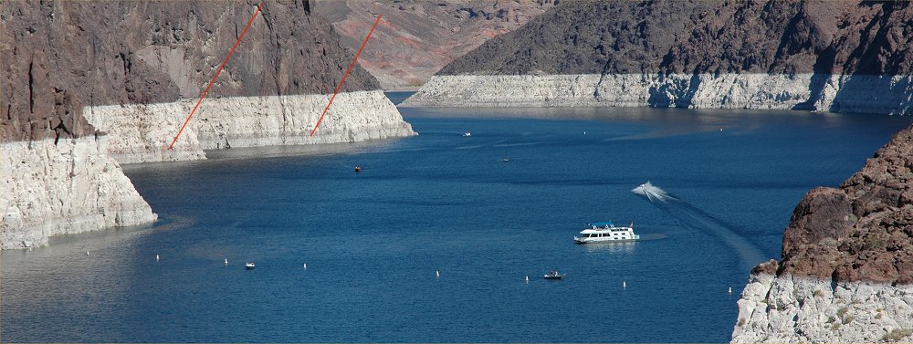
Lake Mead at Hoover Dam
October 2006
All Images
© Ken Dewey, HPRCC, NDMC

Note the
red
lines
which indicate the level of the reservoir in Year 2002.
The reservoir
level has fallen over 18 feet since October 2002.
Here is
a link to the photos of 2002: The
Year 2002 Drought in the Southwestern U.S.

The Elevation
of Lake Mead has been falling since October 1998.
Note the
red
line
which points to the level of the reservoir at capacity.

Note the
red
line
which points to the level of the reservoir at capacity.
The structure
on the right is the spillway used when the reservoir reaches capacity.

This is
the same structure, spillway, shown in the above photo.

Note the
red
lines
in the distance which indicate the spillway on the
opposite
side and the level of the reservoir when it is at capacity. The red line
on the
far left
also indicates the level of the reservoir at capacity.