Lake McConaughy, Nebraska (Update, July 1, 2006)
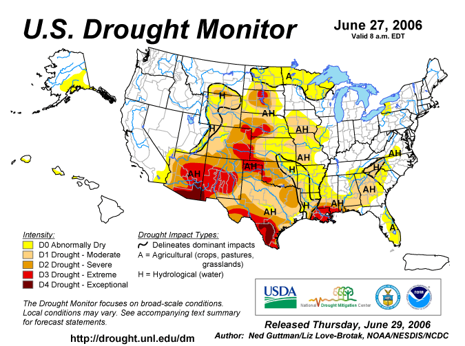
A Major Drought Continues to Severely Impact The Reservoir
Lake McConaughy is falling below the level it was at last year at this time!

See the person along the water's edge?
If not, CLICK HERE OR ON THE PHOTO.
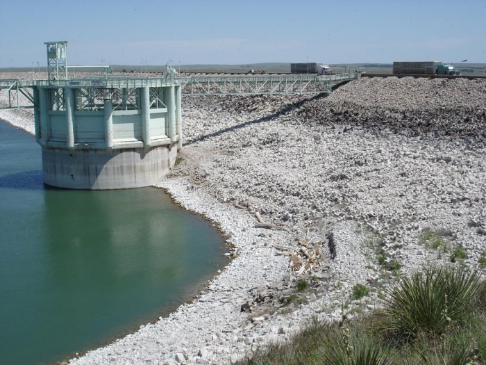

Image © D. Gutzmer, Kingsley Dam at Lake McConaughy, June 2006: High Plains Regional Climate Center.
The top of the white colored rock indicates the height of the standing water under normal conditions.

NOTE:  The reservoir (lake) is full when the water reaches the level of the horizontal boom
which connects the outlet tower on the left and the spillway tower on the right.


Lake McConaughy Elevation June 30, 2005 - June 30, 2006

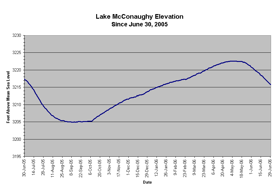
Lake McConaughy Statistics, June 30, 2005 vs June 30, 2006
 
June 30, 2005
June 30, 2006
Difference
Elevation
3217.4 feet
3215.8 feet
-1.6 feet
Below max elevation
-52.6 feet
-54.2 feet
-1.6 feet
% Capacity
36.7%
35.1%
-1.6%
Volume
644,100 acre feet
612,500 acre feet
-31,600 acre feet
Amount below capacity
1,256,500 acre feet
1,288,100 acre feet
-31,600 acre feet
Maximum elevation is 3270 feet.
maximum volume (storage) is 1,900,600 acre feet


Lake McConaughy Quick Facts:
  •  The lake north of Ogallala on the North Platte River is Nebraska 's largest reservoir.
  • It was filled in 1952 after Kingsley Dam's completion in 1941.
  • Lake McConaughy was built for irrigation but it is also popular for recreation.
  • Lake McConaughy is 22.1 miles long at maximum pool and is 142 feet deep at maximum depth when full. 
  • The Outlet Tower height is 185 feet high and the Spillway Tower is 172 feet high.
  • The Spillway Tower has 12 gates which are 16 feet high and 22 feet wide.
  • The Outlet tower is used for normal water release (water enters the tower at the bottom of the reservoir).  Water enters the hydroplant from this tower. 
  • The Spillway Tower is used only in the event of very high water and is a flood control outlet for the reservoir. 
  • Kingsley Dam is 162 feet in height, 28 feet wide at the top and 3.1 miles long.
The information source for these data is the Central Nebraska Public Power and Irrigation District. 


Links to High Plains Climate Center Information about Lake McConaughy:
 Photo Gallery of Lake McConaughy on November 12, 2004.

 Photo Gallery (November 2004) of the Lost Town of Lemoyne which reimerged from Lake McConaughy.
 

Links to the UNL National Drought Mitigation Center Information:
What is drought?

Current Drought Monitor Map

Animation of Drought Monitor Maps (last 12 weeks)


The following map shows the lingering drought in most of Nebraska


LINKS:
Central Nebraska Public Power and Irrigation District
Central Nebraska Lake Levels
Climate Prediction Center 8-14 Day Outlooks
Lake McConaughy
Lake McConaughy Web Cam
No-till on the Plains
Nebraska Public Power District
National Drought Mitigation Center
Water Resources Data for the Nation


Map Showing Location of Lake McConaughy Relative to Interstate 80 in western Nebraska


Return to: The Photo Gallery Index Page