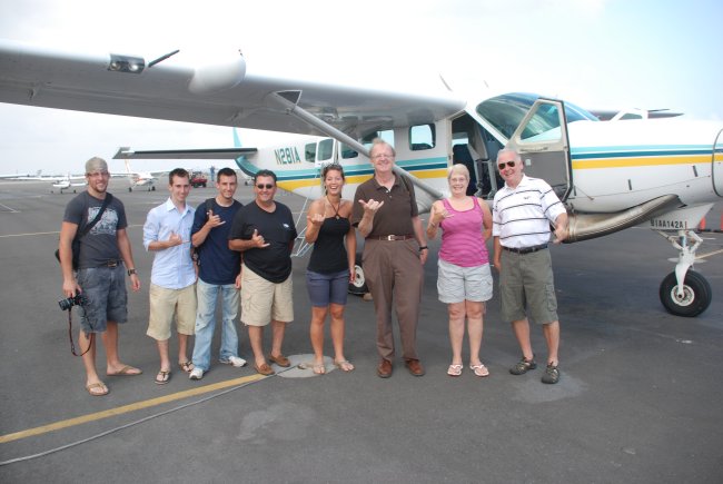
Ready to board the flight over Hawaii conducted by Big Island Air
Aerial Photos of Hawaii, Near Volcanoes National Park: June 2009
All Photos © K. Dewey, SNR, UNL.
Main Photo Index for the Hawaii trip
Ready to board the flight over Hawaii conducted by
Big Island Air
|
Their Cessna Caravans are the only turbine-engine, jet-prop tour airplanes in the state. Originally configured for 13 passengers, they have adopted a 9-passenger configuration for guaranteed window seating and extra comfort for everyone. The safety, reliability and performance of this aircraft coupled with air-conditioning and spacious interior make their airplanes the premier island touring machine |
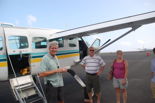
Pilot Greg gives a pre-flight briefing.
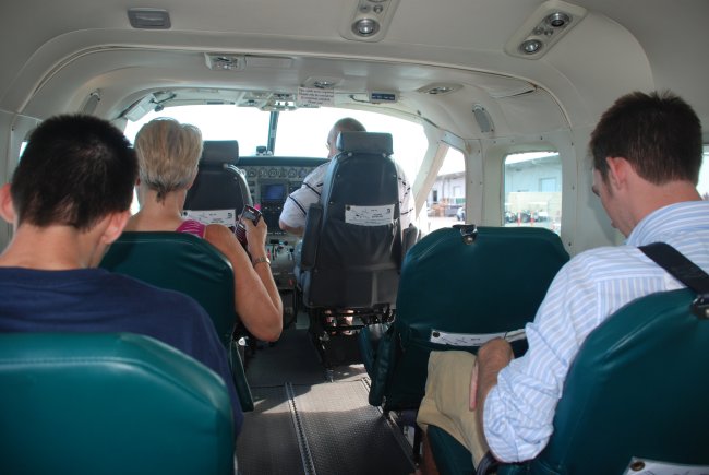
There's plenty of room on the plane, & with a turboprop engine, the
flight was smooth and perfect for photography
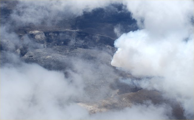
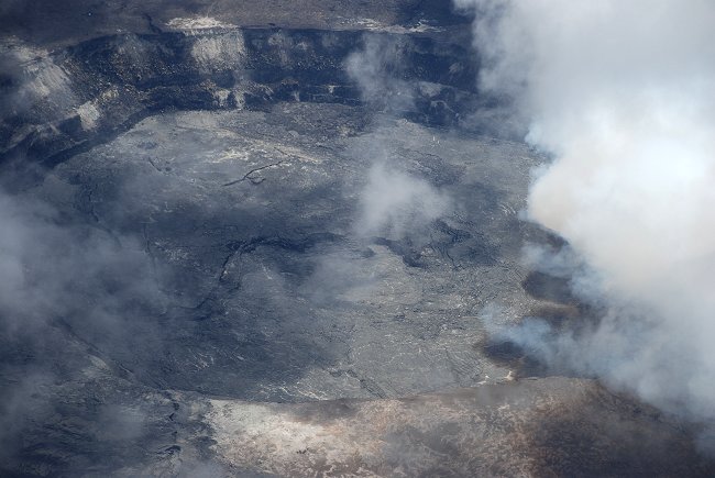
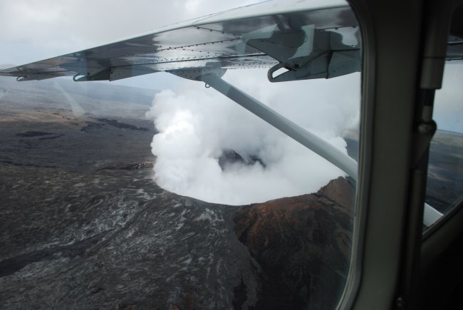
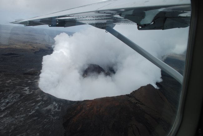
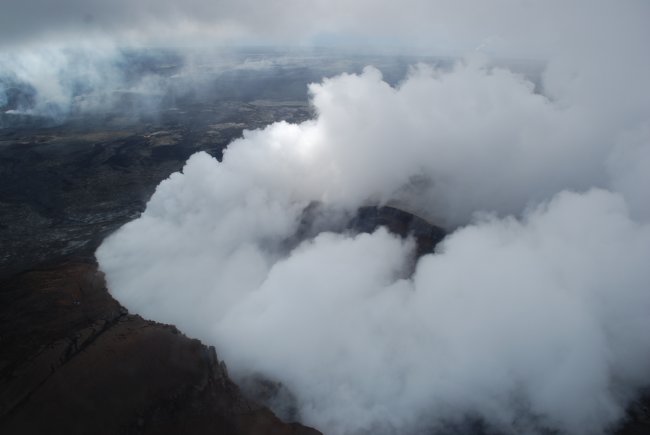
Kilauea crater in Volcanoes National Park with
smoke coming from the Halema`uma`u Crater
| A portion of Crater Rim Drive, between Jaggar Museum and the Chain of Craters Road junction, is closed indefinitely due to the new vent that opened within Halema`uma`u Crater (inside the larger Kilauea crater) in March 2008. Note: Chain of Craters Road remains OPEN. Lava flows are flowing to the ocean both inside and outside the eastern boundary of the park. However, lava is very far (9 to 11 miles roundtrip) from the end of Chain of Craters Road within the park. The easiest access for visitors is outside the park, via Hwy 130. For more information visit: Lava Flows to the Ocean. |
Kilauea crater in Volcanoes National Park
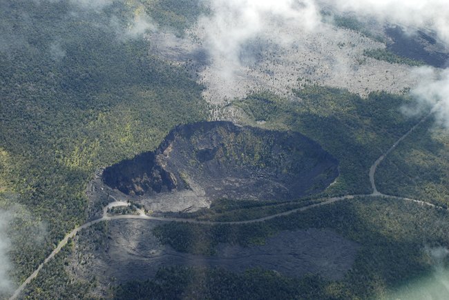
The "chain of craters" road in Hawaii Volcanoes National Park
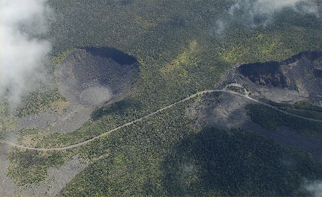
The "chain of craters" road in Hawaii Volcanoes National Park
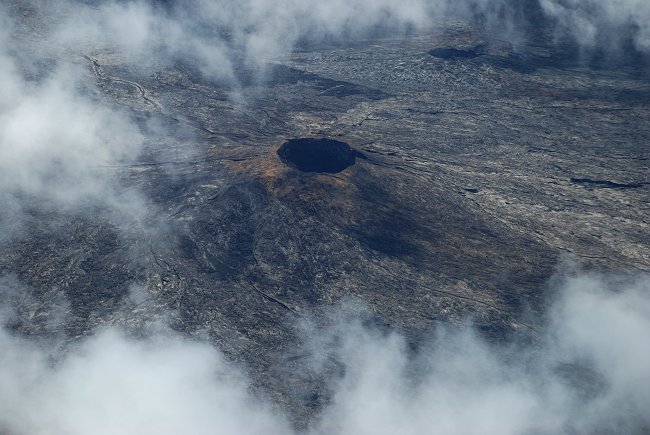
A dormant volcanic cone in Hawaii Volcanoes National Park
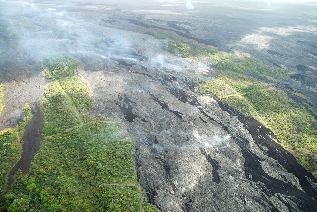
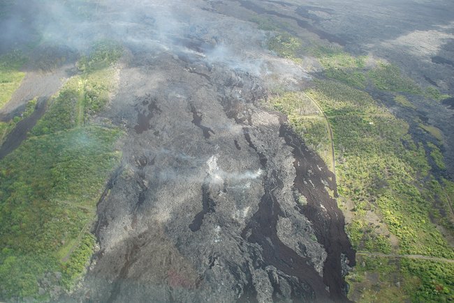
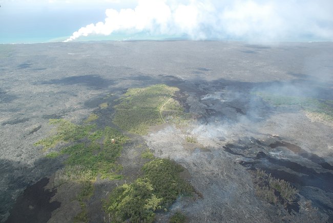
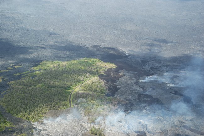
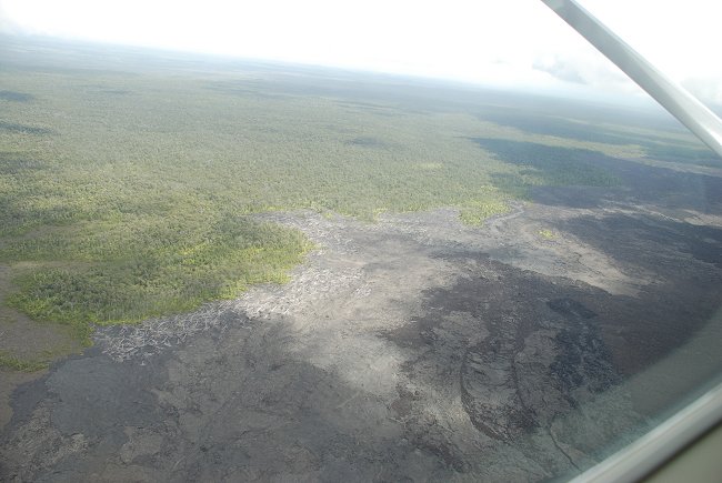
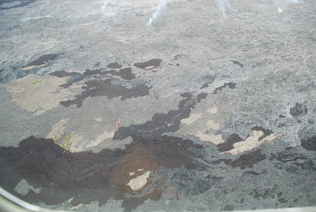
Lava flows just southeast of Volcanoes National Park. Note the
remaining roads and trees.
The top of the lava flow is crusted over (gray in color) with some smoke
coming up through the lava.
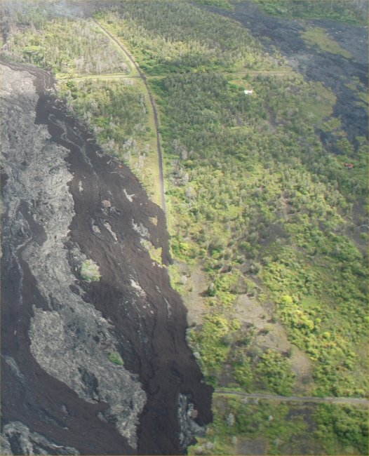
Note the active lava flow (gray color) in the middle of the photo.
Smoke rises from the lava flow and a small portion of forest and roads
remains uncovered
This is the main lava flow coming out of the
Kilauea volcano.
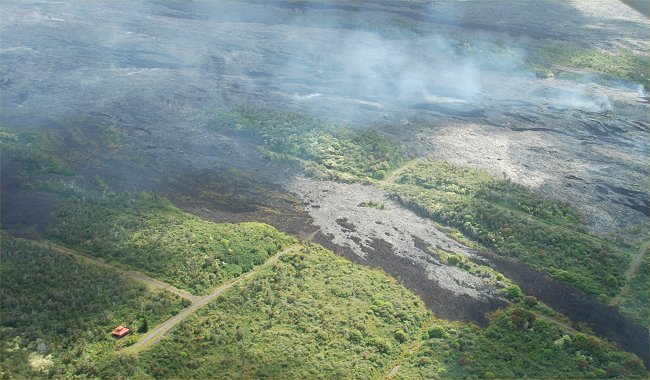
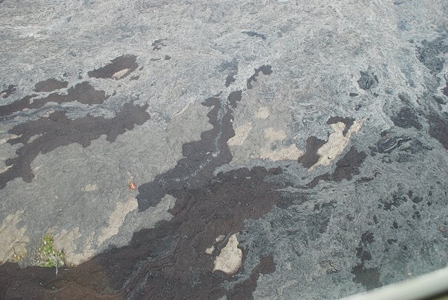
The lava flows have eliminated several neighborhoods just outside the
park.
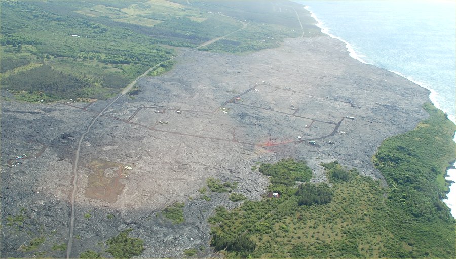
This lava flow covered almost all of Kalapana Gardens (see map below).
Rebuilding has started to take place.
a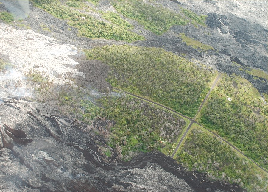
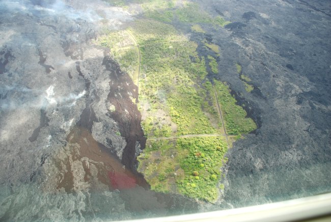
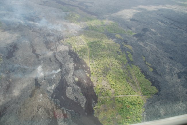
Note the remaining roads and one remaining home toward the right edge of
the photo. This was the Royal Gardens area.
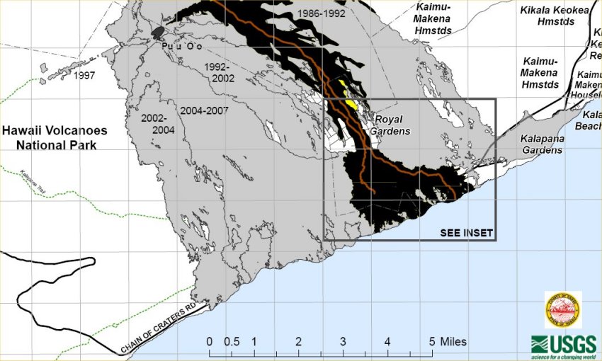
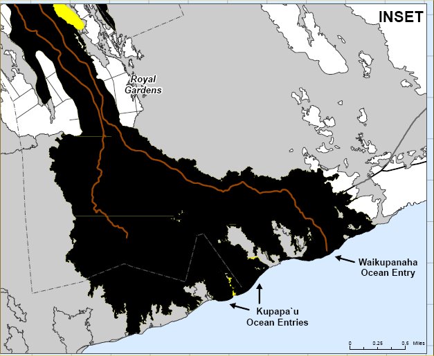
Here are two maps of the lava flows in this area. Photos continue after the maps.
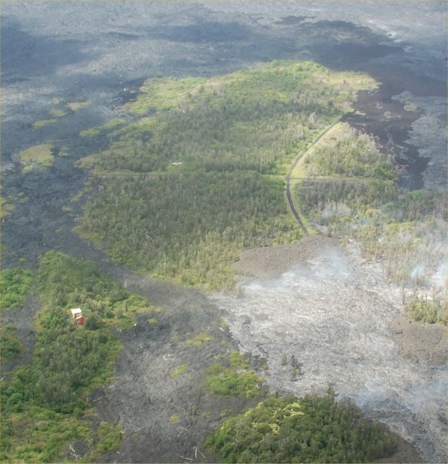
A new tongue of flowing lava is eliminating the remaining portion of
forest SE of the Park.
New lava flow, and burning trees are evident. Note the house to
the left.
Zooming in closer to the house surrounded by lava.
Smoke rises from the fresh lava (gray surface, lower left).
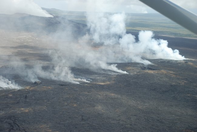
The Pu'u Oo Crater, is off to the left and smoke marks the path of the
underground lava flow
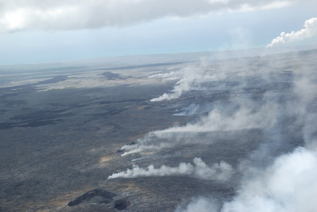
The main lava tube stretches from the volcano down to the ocean (note
the steam plume in the distance).
The Pu'u Oo Crater, with smoke rising
The Pu'u Oo Crater, with smoke rising
Close up view
Note the lava spreading into the forest with trees that have burned and
fallen to the ground on the left.
Smoke rises from the lava
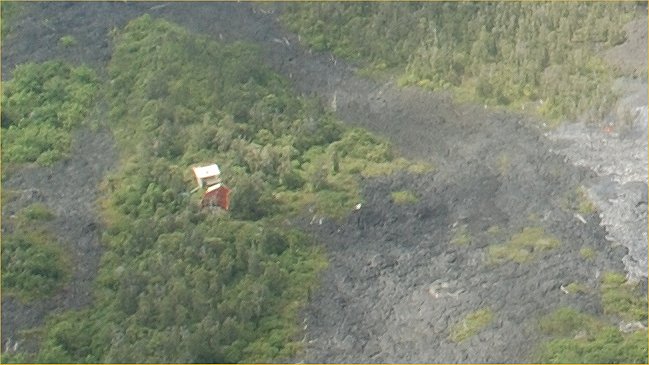
There is a house remaining (redish color roof, toward the lower left)
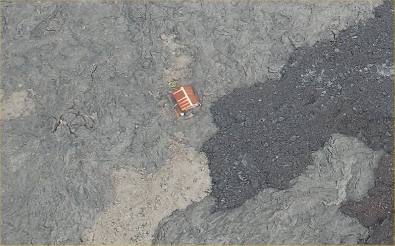
Here is a close up of the house in the above photo.
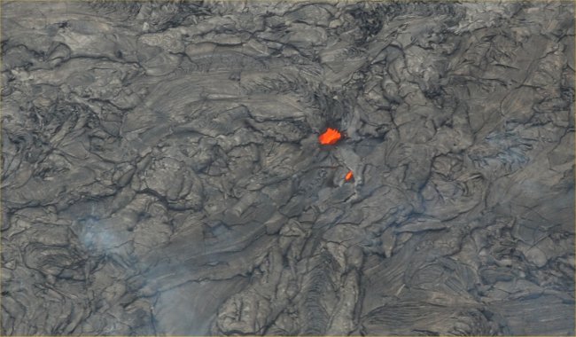
This is an opening to the main lava tube. The red is the hot
(1,000F) lava just beneath the surface.
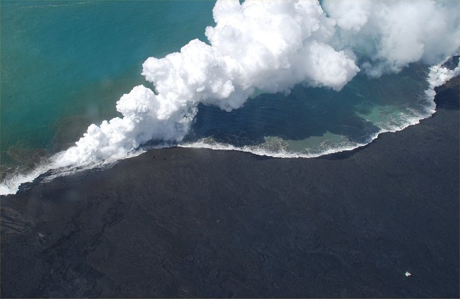
This is where the main lava flow enters the ocean. Note the white
object lower right corner.
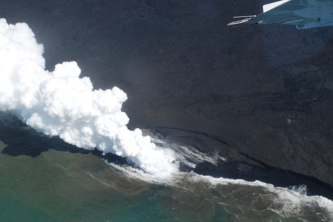
The shelf built up by the lava begins to collapse
The shelf further collapses
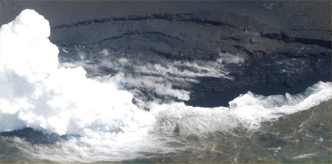
Close up view of the steam plume where the lava enters the sea
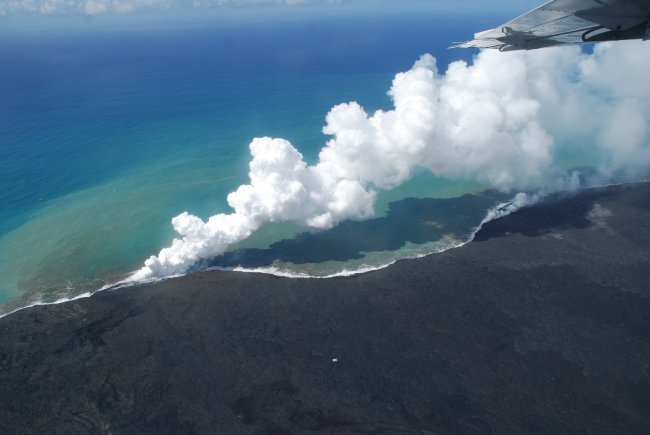
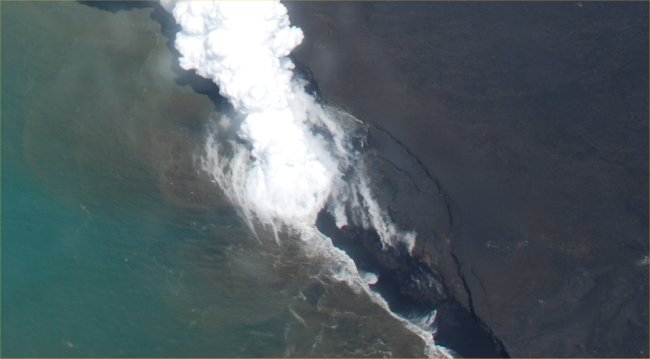
Note the white object in the lower center....its a house!
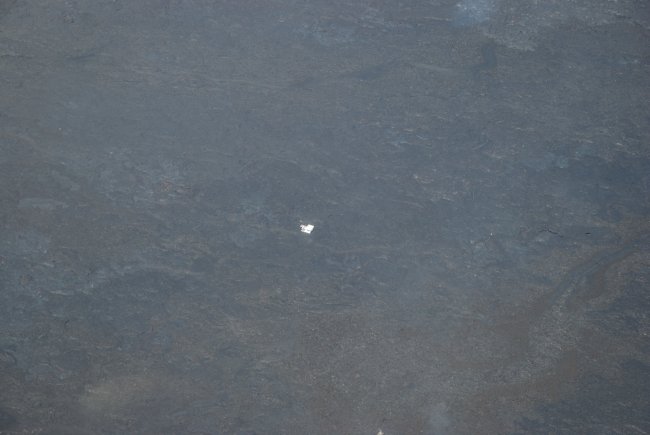
closer view of the house
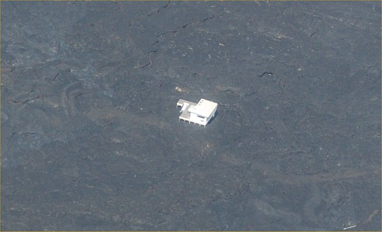
and closer yet. Note the house is on stilts and survived the
repeated lava flows.
.